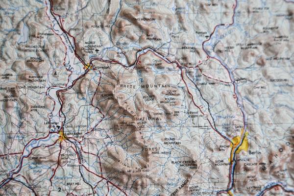
White Mountains New Hampshire 3D map.
Lewiston
29.5 x 21 in.
Edition 3-DMATIC
Lewiston, Maine
New Hampshire, Vermont
NL 19-10
Series V501P
Produced by Hubbard Scientific Inc. Chippewa Falls, WI 54729
Stock No. V501XNL1910**03
Contour Interval 100 Feet
Heavy Plastic.
The White Mountains map is an elevation-based illustration printed on a sturdy plastic sheet. That 2-dimensional map is then thermo-formed using a proprietary technique to conform to a detailed terrain model, creating a precisely molded 3D map.
Each of the 48 4000-footers is labeled, as are hundreds of lower peaks, trails, shelters, trailheads, key geographic features, roads, creeks/streams/ponds, and other landmarks.
White Mountain National Forest
Unframed.
Like New.
$24.00